
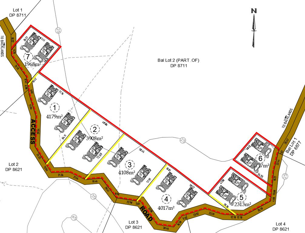

An incredibly lifelike, richly detailed, photorealistic aerial floorplan photo of a residential subdivision. The scene is illuminated by a neutral, overhead light source, creating a clear and informative atmosphere, as if viewed from directly above and without shadows. Captured with a wide-angle lens, emphasizing the precise layout of multiple lots, each marked with a red boundary and containing miniature representations of houses, complete with individual driveways and surrounding greenery. The varied lot sizes are clearly indicated within each parcel, with some lots distinguished by yellow bordering. The subdivision is bordered by roads labeled "ACCESS" and "ROAD," with connections to other areas indicated as "TO BACKLANDS." Dashed lines suggest various property boundaries and easements, while circular markers with numbers likely denote lot identifiers or survey points. The composition offers a comprehensive overview of the development, highlighting the spatial relationship between the individual housing units, their respective plots, and the overall infrastructure of the development. The perspective is clean and technical, akin to a detailed architectural rendering or a surveyor's plan brought to life with realistic, albeit simplified, visual representation.