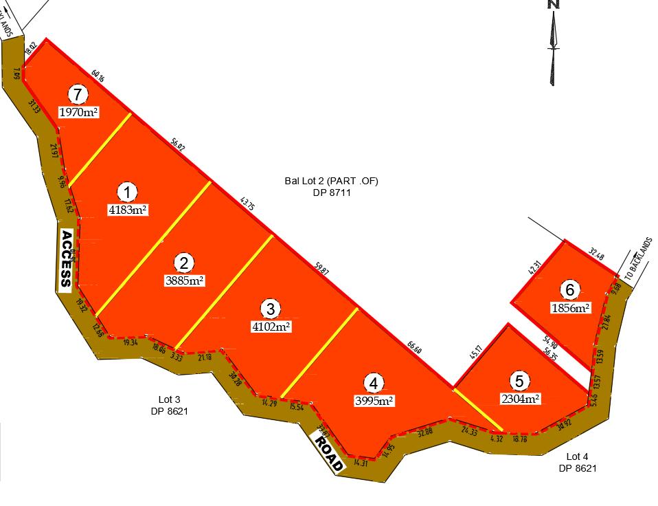


An incredibly lifelike, richly detailed, photorealistic aerial floorplan photo of a planned land subdivision. The scene is illuminated by a clear, overhead daylight, creating a crisp, informative atmosphere. Captured with a high-resolution drone camera, emphasizing the sharp red outlines of the property boundaries against the earthy brown of the undeveloped land, with bright yellow lines delineating internal lot divisions and clear white text labeling each plot (numbered 1 through 7) with its respective area, such as "4183m²" for Lot 1. The perspective is a clean, top-down view, showcasing the arrangement of seven distinct lots, with labels like "ACCESS," "ROAD," "Bal Lot 2 (PART .OF) DP 8711," "Lot 3 DP 8621," and "Lot 4 DP 8621" providing essential spatial context. The composition is meticulously organized, clearly presenting the layout and dimensions of each parcel, with a small north arrow in the upper right corner orienting the scene. The edges of the image reveal hints of surrounding landscape, including "LANDS" and "BACKLANDS," and the "ROAD" designation suggests an entrance or thoroughfare.